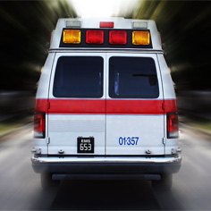
Fastest Route for an Ambulance
In a medical emergency, seconds can mean the difference between life and death. Traffic congestion, the route taken and how intersections are navigated can all affect the amount of time it takes an ambulance to reach the hospital.
But what if the ambulance knew the fastest and least congested route? What if the traffic signals were all green before the ambulance approached? And what if cars were cleared out of the way before the ambulance hit the intersection?
These are all questions Carnegie Mellon's Hend Gedawy (CS'09) tackled in her senior thesis project.
"Traffic is horrible in Doha. I've seen ambulances get stuck at intersections because there were so many cars and they could not get out of the way," said Gedawy. "So I wanted to do something to help people who need medical care."
Building on state-of-the-art vehicle path planning, Gedawy's project proposes to combine dynamic-path planning with traffic signal pre-emption.
Dynamic-path planning is when the path — in this case of an ambulance — is continually updated as new information becomes available. Pre-emption is when an approaching emergency vehicle overrides a traffic signal allowing that vehicle the right-of-way.
By using an informed search algorithm, Gedawy aims to create a system that will reduce emergency vehicle delay while maximizing traffic flow through an intersection.
Traffic signals would be responsive instead of timed, meaning the light would change when vehicles arrived at the intersection. This would keep traffic flowing smoothly at intersections, alleviating congestion when an ambulance approaches.
Also, signal emitters would be fitted to both the emergency vehicle and the traffic signals. So if an ambulance were en route to a hospital, it would have a continued stream of green lights along the way.
"Responsive traffic lights don't exist here," said Gedawy. "So people sit at intersections and wait for a long time when there is no one even coming the other way. It's worse if there is an ambulance because sometimes people try to move out of the way but there is nowhere to go."
Advancements in GPS technology have aided in this type of research by more accurately detecting locations. Dynamic-path planning has also furthered this field by providing up-to-the-second traffic conditions and suggesting an optimal path based on the traffic.
Gedawy is hoping these advancements coupled with her plan, which specific to the traffic situation in Qatar, will one day be the standard on roads all over Doha.
Related Links: Carnegie Mellon in Qatar | School of Computer Science
Homepage Story Archives